
Source review · Practical recommendations are editorial suggestions.
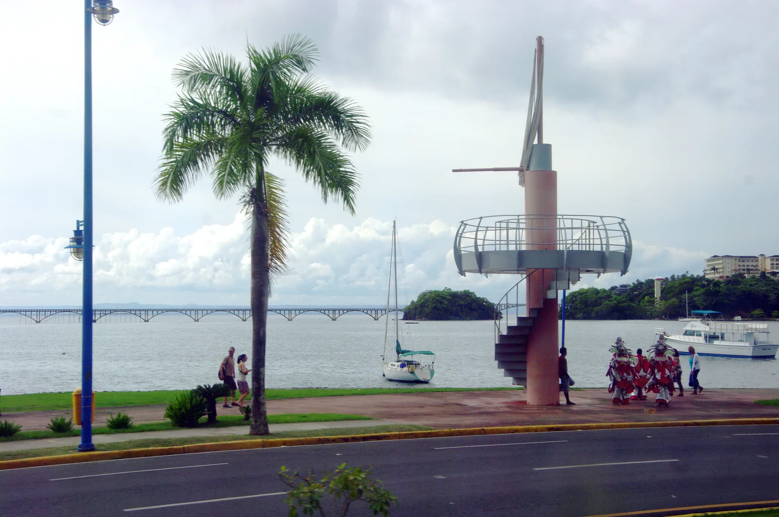
Use Samaná as a starting point for understanding the peninsula: its bay, coastal scenery and different towns reward a deliberate choice of base. Santa Bárbara de Samaná and Las Terrenas are separate places, not interchangeable hotel areas. Our map point marks Samaná town for orientation.
A GOOD FIT FOR
Your kind of trip
Travellers who want nature and a choice of coastal settings.
BEFORE YOU CHOOSE
The practical side
A peninsula itinerary needs transport planning between its towns and attractions. Leave space for the journey as well as each stop.
Choose your base
Choose whether you want to stay by Samaná Bay or around Las Terrenas on the north coast of the peninsula. Build the rest of your plan around that choice.
Santa Bárbara de Samaná and the bay
Use a bay-side base if the town and bay are central to the trip you want. This is a different location from Las Terrenas. Put your intended outings on the map first, then compare accommodation against their actual departure points. A hotel described as “Samaná” may refer to the peninsula rather than the town.
Las Terrenas on the peninsula’s north coast
Compare a Las Terrenas stay when you want a coastal-town setting with beaches among your everyday plans. Choose it as its own base; a stay here is not a stay in Samaná town. Our separate Las Terrenas guide helps you compare the town setting with nearby beach areas.
Las Galeras and the eastern peninsula
The tourism authority lists Las Galeras and Playa Rincón among peninsula visits. If these anchor your trip, investigate accommodation in that part of the peninsula and the transport each outing requires. Do not assume that every beach visit is a short local journey from either Samaná town or Las Terrenas.
Places to put on your shortlist
NATURE & OUTDOORS
Cayo Levantado
An island in Samaná Bay to investigate through a specific boat itinerary or accommodation arrangement.
The marker is an island orientation, not a departure or landing point. Confirm which areas and facilities are part of your actual booking; an island visit does not imply access to a resort.
View on map →Sources & review notes
Reviewed 2026-10-31. Practical recommendations are editorial suggestions; confirm current access and arrangements with the relevant operator.
Map point: Coordinate source. Approximate orientation, not an entrance or pickup point.
PLAN A VISIT WITH OUR GROUP
NATURE & OUTDOORS
El Limón waterfall
A nature outing on the Samaná peninsula to investigate separately from a town or beach day. Plan the approach and return from your actual base.
The marker represents the waterfall area, not a trailhead. Confirm the route, physical demands, current conditions, guide arrangements and return transport. Do not infer accessibility or suitability from the map.
View on map →Sources & review notes
Reviewed 2026-10-30. Practical recommendations are editorial suggestions; confirm current access and arrangements with the relevant operator.
Map point: Coordinate source. Approximate orientation, not an entrance or pickup point.
PLAN A VISIT WITH OUR GROUP
BEACH IDEA
Playa Rincón
A beach visit in the Las Galeras part of the Samaná peninsula. Put the journey from your actual accommodation into the plan before choosing other stops.
Arrange the actual access and return locally. The map point is a beach-area orientation only, not a road endpoint or boat meeting point. Confirm current conditions directly.
View on map →Sources & review notes
Reviewed 2026-10-30. Practical recommendations are editorial suggestions; confirm current access and arrangements with the relevant operator.
- Ministry of Tourism — samana
- Mapcarta — Playa Rincón geographic orientation (GeoNames / OpenStreetMap)
Map point: Coordinate source. Approximate orientation, not an entrance or pickup point.
Playa Rincón from Las Galeras: road or boat? Compare the starting point, beach time and complete return journey before choosing your outing.
Arrive with a plan
Investigate AZS, then the exact accommodation
Start with the AZS arrival guide when comparing flights for the Samaná peninsula. A gateway recommendation is geographic orientation: available flights, the final property and the operator’s confirmed route determine the actual journey.
Keep the first day flexible
Check the local arrival date and accommodation check-in arrangements. Obtain written pickup instructions before departure and keep them available offline. Avoid building an immediate paid outing around an assumed arrival or driving time.
Getting around your base
Use the actual accommodation address when comparing an outing or pickup. Ask where the visit starts, how you return and what is included. A saved map point is an approximate location, not a verified entrance or walking route. Check changing access details directly before setting out.
How long should you stay?
Editorial suggestion · five nights in one peninsula base
Use one base and leave room for arrival, a town or beach day, a confirmed nature outing and an uncommitted day before departure. Five nights is a sample planning budget, not a requirement. Change the outline if your flight dates or the journeys you want would make another arrangement more practical.
Two ways to shape the visit
A beach-led peninsula stay
Choose the coastline and property first, then save individual beaches rather than a general list of every attraction in the province. Leave space to check the local conditions and return transport for each visit.
A nature-led stay
Investigate El Limón and bay-based experiences as separate outings. Ask about the route, physical demands, actual departure location and current conditions before booking. Seasonal wildlife experiences need a current operator check; no sighting is promised by this guide.
Other bases in this region
Compare before you choose
Make the next decision
Sources & review notes
Reviewed 2026-10-30. Practical recommendations are editorial suggestions; confirm current access and arrangements with the relevant operator.
- Dominican Republic Ministry of Tourism
- Dominican Republic Ministry of Tourism
- Ministry of Tourism — airport gateways
Map point: GeoNames. Approximate orientation, not an entrance or pickup point.
Balou46 / Wikimedia Commons · CC BY-SA 4.0 · cropped & resized